
Find Mesquite Neighbors Around a Parcel
A block search needs a source-by-source approach. The parcel map shows the geography around an address. DCAD supplies appraisal fields for each selected parcel. The clerk’s index can establish a recorded ownership document. Texas voter information is an individual confirmation channel, and neighborhood resources connect people with a group rather than publishing member names. The table separates those roles so a block result is not overstated.
| Block source | What it shows near an address | Access and limit |
|---|---|---|
| DCAD parcel map | Adjacent parcels, account or address search, reports, and map tools | Free public map; appraisal data and approximate boundaries |
| Mesquite GIS parcel service | City or ETJ layer, flood context, parcels, and subdivisions | Public map query; layers have a record cap and mapping disclaimer |
| Dallas recorded index | Recorded parties, legal descriptions, and documents across parcels | Public index; images or certification may enter a paid path |
| Texas voter information | Registration and polling information for a named voter | Individual confirmation; protected fields and addresses are withheld |
| Neighborhood Vitality | Registered-group, block-leader, and watch-startup connection | City resource, not a resident or member roster |
| HOA certificate search | Association name, city, ZIP, and certificate metadata | State search warns that data are user-contributed and may be incomplete |
Appraisal ownership and occupancy are different facts. An owner may receive tax mail elsewhere, and a homestead indicator is an appraisal or exemption signal rather than a current household count. A parcel boundary does not say who is visiting, staying, or otherwise connected with an address.
Map Mesquite Neighbors Parcel by Parcel
The adjacent-parcel method keeps the search limited to the immediate block. Use the account number as the handoff between map and appraisal record. Build a list one parcel at a time, because a block can contain multiple lots, a combined parcel, or a boundary that does not match the street’s visual layout.
- Enter the target in the DCAD map’s Search Parcel control, or use its address, account, or owner format. Select the target and save the account number.
- Click the neighboring parcel polygons or pan along the block. Clear the first selection before collecting the next account.
- Open the DCAD record for each saved account. Keep the situs address, appraisal owner, mailing address, subdivision, and legal-description reference with the correct parcel.
- Use the legal description or subdivision in the Dallas County index if a dated ownership document is needed. Do not merge separate lots into one record merely because they face the same block.
- Check city-limit or ETJ status before selecting a county office. For a broader named-street chain, use the Mesquite street directory rather than treating the block list as a full street search.
The DCAD Property Map supplies Search Parcel, Locate, Measure, Legend, Create Map, and Create Property Report tools for the first part of that process.
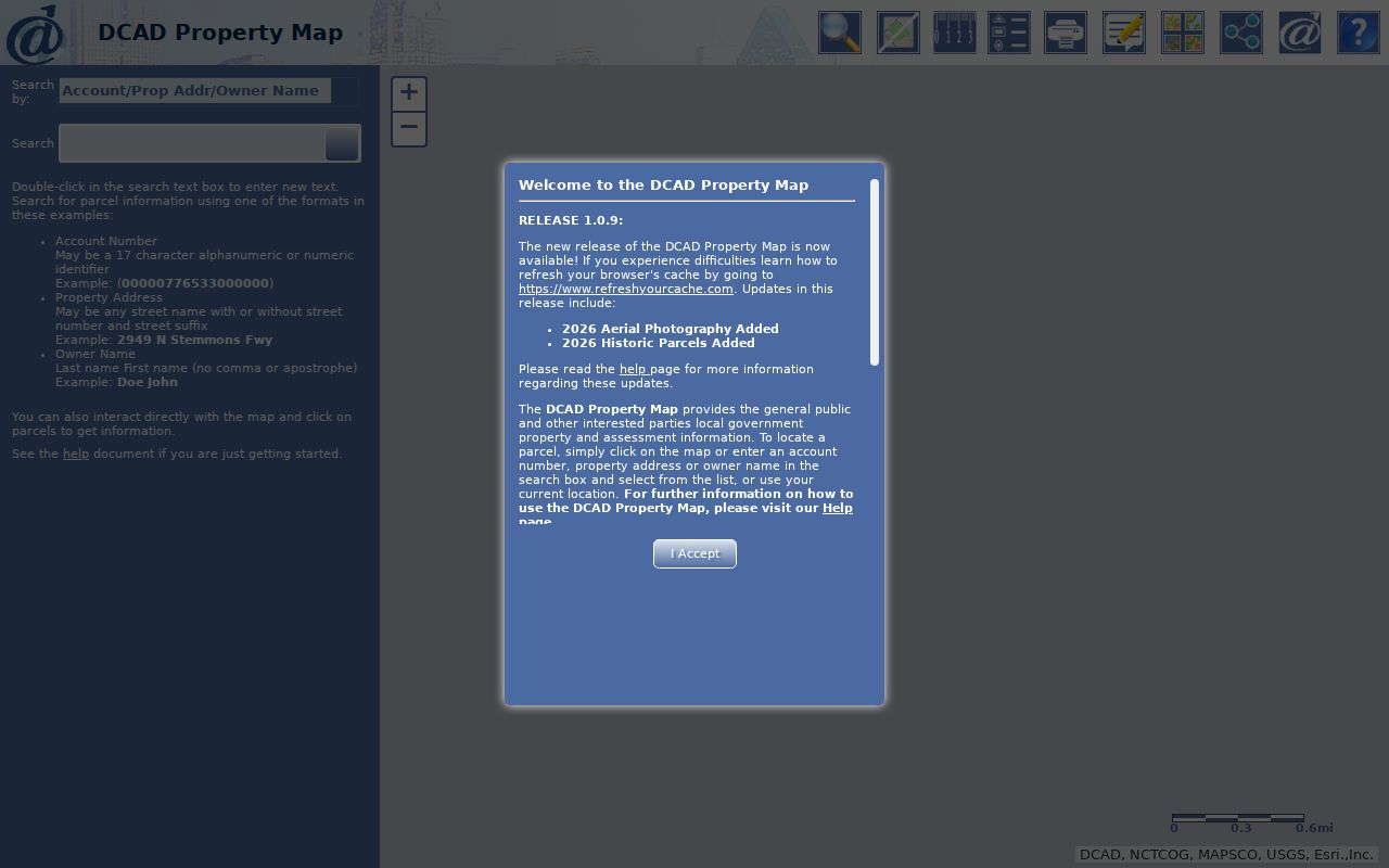
The measurement controls can mark a working segment, but they do not establish a legal boundary or a count of people associated with the block.
Mesquite Neighbors GIS Layers
The Mesquite parcel ArcGIS service adds the jurisdiction layer that a parcel card cannot supply alone. Its listed layers are Mesquite City Limit, Mesquite ETJ, Floodplain, DCAD Parcels, and Subdivisions. It supports Identify and query work, plus JSON, GeoJSON, and PBF formats, with a maximum record count of 1,000.
This Mesquite GIS layer screen shows the parcel, subdivision, city-limit, ETJ, and flood layers available for block context.
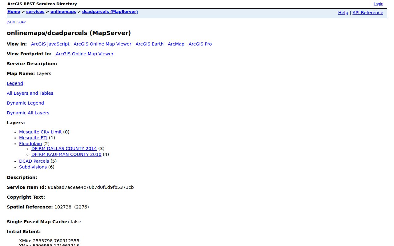
The flood layers identify Dallas County 2014 and Kaufman County 2010 DFIRM sources. They can help flag a location question, but they do not replace a survey, deed, or custodian response. Map information is provided for reference and must be verified when a record decision depends on it.
Mesquite’s incorporated area is in Dallas County. Its ETJ extends about five miles into western Kaufman County, roughly 19 square miles, primarily south of Forney and west of Crandall. A postal Mesquite address is therefore not enough to decide city status, county jurisdiction, or a voting precinct.
Mesquite Neighbors Through Recorded Deeds
When a parcel needs an ownership timeline, use the Dallas County official-records portal. Its Property Records quick search accepts a grantor or grantee, subdivision, document type, or document number. It has Index Only and Index & Full Text OCR options, recorded-date fields, and preset date ranges. The portal is public and non-certified; images or certified copies can require a cart, login, or payment path.
Search the current appraisal owner as grantee. Record the parties, document number, recorded date, and legal description, then search the seller as grantee to follow an earlier acquisition. A legal description is the lot, block, subdivision, or other land description within the document. It is the bridge when an older deed does not use a modern street address.
Dallas County’s custodian says county records reach back to 1846, but the inspected online portal did not show its oldest searchable index year. For older or temporarily unavailable records, use the clerk’s counter or public terminals, request forms, library microfilm, or Texas State Library material. The gap is an access fact, not permission to assign a date the portal does not publish.
Mesquite Neighbors and Voter Records
The Texas voter-information lookup confirms one named person’s registration and polling information when the official matching options are met. VoteTexas identifies VUID, Texas driver’s-license number if supplied, and first and last name as matching options. The live form did not render during research, so its exact controls and result columns are not verified. The city voting map is different: it maps an address to a precinct, polling place, and districts, not to names.
A formal state voter-file request has a different scope and legal boundary. The inspected form describes permanent and mailing address, precinct, status, and election fields, but requires a notarized affidavit and a $75 deposit. It states a response no later than the fifteenth day after receipt and makes commercial advertising or promotion use unlawful. Texas Election Code sections 13.004 and 18.005 also withhold sensitive identifiers and protected-address information.
Protected voters and ACP participants do not have ordinary block-level address display. The state file is not a substitute for an individual lookup, and neither source should be presented as a complete block list.
Note: The public voter route confirms registration context for a named person, while the city map provides location context for an address.
Mesquite Neighborhood Vitality Groups
Mesquite Neighborhood Vitality is the local connection point for registered neighborhood groups, volunteer leaders, neighborhood walks, block-leader plans, a toolkit, and starting a Neighborhood Watch. The city gives 972-216-6348 for Neighborhood Watch startup. It does not publish private member or resident lists, so the resource is best used to find the proper public contact path.
This Neighborhood Vitality resource documents the city’s registered-group and block-leader support rather than a roster for homes on the block.
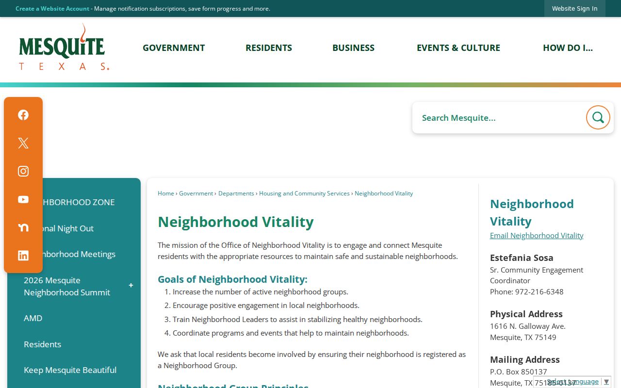
A group contact can describe a meeting, project, or participation path. It cannot confirm that a person belongs to a group or lives at a nearby parcel.
Registered groups
Neighborhood Vitality supports registered-group contacts and neighborhood walks. Ask the office for the appropriate public connection, not a private roster.
Block leaders
Block-leader plans and the toolkit are civic resources. Participation is voluntary and cannot be inferred from an address.
Neighborhood Watch
Use the city’s Neighborhood Watch startup route at 972-216-6348 for an official beginning point.
Mesquite Neighbors Plan Areas
Mesquite Neighborhood Plans identify four formal planning areas. Their boundaries supply local context for an address, but the plans focus on code enforcement, infrastructure, and historic preservation. They are not lists of people.
| Plan area | Published boundary streets |
|---|---|
| Truman Heights | North of US 80, southwest of N Galloway, and southeast of Hillcrest |
| Casa View Heights | La Prada, Sherwood, Oates, and Gus Thomasson |
| Mesquite Park | Newsom, Wilkinson, Sierra, and Lindo |
| Sherwood Forest | Scyene, S Sam Houston, W Bruton, and Peachtree |
Those areas were prioritized by a 2004 Residential Building Condition Survey. The historical detail is a useful way to understand the block’s planning context, not a reason to infer a resident’s identity or community involvement.
Mesquite Neighbors Data Comparisons
Official sources and commercial neighbor tools serve different purposes. A commercial compilation may combine public filings, marketing data, historical addresses, and uncertain matches. It can be stale or duplicate people, and it cannot overcome protected records or prove a current household. Use the underlying custodian record when a fact needs confirmation.
| Source category | Best use | Important limit |
|---|---|---|
| Official parcel and deed records | Locate a parcel, appraisal owner, legal description, or recorded conveyance | Does not prove all current occupants |
| Official voter routes | Confirm one named voter or map precinct geography | Protected data and non-roster limits apply |
| Neighborhood and HOA resources | Identify a public group or association contact path | Organization data is not membership evidence |
| Commercial neighbor tools | Possible lead to verify with a custodian | May contain stale, merged, or incomplete information |
The Texas Data Privacy and Security Act can give consumers rights with covered private controllers. It does not rewrite a county deed, a DCAD record, or a protected voter file. For an error, use the correction channel of the office that holds the original record.
Mesquite Neighbors Privacy Limits
Public block research leaves important facts private. Household members who are not named in an owner, voter, or historical directory record may not appear. Guests, utility customers, and DMV addresses are not routine public directory fields. Texas ACP protections, protected voter procedures, sealed cases, and juvenile details also restrict what can be disclosed. A vacant result does not establish that no one is connected with a parcel.
Texas Public Information Act requests can seek existing city or county records, but an agency does not have to create a new record or answer an open-ended question. When an online permit, code, police, or older clerk record is not available, send a narrow request with an address, record type, date range, and preferred format. Redactions and exceptions can still apply.
Lawful use. Use block-research information for personal, lawful purposes such as community connection, family research, property questions, or confirming a custodian record. Texas Penal Code sections 42.07 and 42.072 address harassment and stalking; never use an address or record to watch, threaten, or repeatedly contact someone.