
Mesquite ZIP Code Directory Coverage
Mesquite is served by postal destination groups and by Census ZIP Code Tabulation Areas, called ZCTAs. They answer different questions. The official Census profile lists ZCTAs that intersect Mesquite geography. Archived USPS material identifies some Mesquite destination groupings, but it does not replace the current address result. Treat the table as a record-research index: it shows why an address should be verified one delivery point at a time before choosing a city or county custodian.
| ZIP | Area relationship | Post office or service note | Research caution |
|---|---|---|---|
| 75149 | Mesquite core destination | Mesquite destination group | Portions can cross parcel or city boundaries. |
| 75150 | Mesquite destination in archive tables | Mesquite destination group | Verify current address service. |
| 75180 | Mesquite and Balch Springs postal history | Destination label can vary | A 2019 Postal Bulletin records a change or redirect history. |
| 75181 | South and east Mesquite context | Mesquite destination group | City and ZCTA boundaries can differ. |
| 75182 | East and northeast Mesquite context | Mesquite destination group | Check exact delivery city and county. |
| 75185 | Mesquite and Balch Springs transition history | Archived Mesquite grouping | Do not assume a current preferred-city label. |
| 75187 | Older Mesquite grouping with 75150 | Service type not verified | Current PO-box or unique status was not located. |
| 75043, 75114, 75126, 75159 | ZCTAs that intersect the Census city profile | USPS service city varies | An intersection does not make every address a Mesquite mailing address. |
The Census list also includes 75149, 75150, 75180, 75181, and 75182. Its ZCTA coverage is geographic context, not a definitive postal delivery list. The core archived groups were 75149, 75181, 75182, and 75185 under one Mesquite grouping, plus 75150, 75180, and 75187 under another. Current USPS verification remains the deciding step.
Mesquite Postal Destination Groups
Postal labels can be broader than an incorporated city. Mesquite is in east-central Dallas County, yet its extraterritorial jurisdiction extends about five miles into western Kaufman County. Its parcel service has separate city-limit and ETJ layers. A Mesquite mailing address therefore cannot, by itself, select Dallas County rather than Kaufman County, prove that the parcel is inside the city, or choose a voting precinct. Save the postal city, county, city-limit or ETJ status, and legal parcel description together.
The city’s planning resources include 2006 annexation, 2008 subdivision, and 2011 zoning maps. Those maps can help explain why an old deed uses a jurisdiction or subdivision term that does not match a present address. No official source in the research verified a citywide street renumbering or readdressing year, so an apparent address change needs a parcel or legal-description check instead of a guessed date.
Verify a Mesquite Postal Code
Use the USPS address lookup before searching local records. It has separate By Address, By City and State, and Cities by ZIP Code modes. By Address requires a street address, city, and state, with company, apartment or suite, and ZIP fields available as applicable. The service warns that a ZIP result does not confirm that a person or company is at the address. Add the unit for multi-result addresses and retain the result date.
The USPS ZIP Code Lookup shows the available address and city-state verification modes for this Mesquite ZIP code directory.
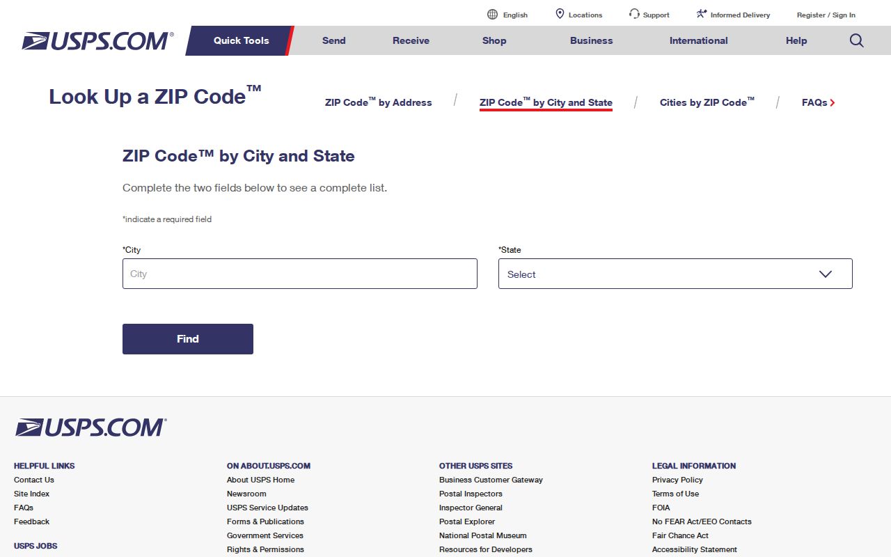
USPS verification resolves a delivery question first, which is more reliable than applying an archived postal grouping to an individual parcel.
| USPS mode or field | Observed use |
|---|---|
| By Address | Uses street address, city, and state, with optional company, unit, or ZIP information. |
| By City and State | Finds ZIP choices from a city and state entry. |
| Cities by ZIP Code | Checks the city relationship for a ZIP entry. |
| Find | Runs the selected lookup mode. |
Find Residents by Mesquite Postal Area
A ZIP can narrow research, but the local tools inspected do not offer a universal ZIP-wide resident search. First verify the delivery address with USPS. Next locate the parcel in DCAD or the map and save its exact situs address and account number. Then use the property, court, voter, or archive channel appropriate to the question. A ZIP is a starting filter, not a finding that every listed name belongs to an address or block.
- Run an exact address through USPS and save the ZIP, postal city, and unit where applicable.
- Use DCAD by address or the parcel map to identify the situs, account, subdivision, and appraisal owner.
- Check the city-limit and ETJ layers before choosing Dallas County or a Kaufman County custodian for an edge-area address.
- Use a formal voter-data request only when its documented county or precinct options fit the need, and keep its access limits in mind.
Once the ZIP has narrowed the address, the Mesquite by-street directory has the fuller address, parcel, and legal-description workflow. Note: A postal ZIP is useful for finding a delivery area, but it does not define legal jurisdiction or a complete household.
DCAD Limits for Mesquite ZIP Research
The DCAD By Address search is the fastest property starting point for many Mesquite addresses, but the inspected form did not expose a ZIP field. It offers separate owner, account, address, business, and map modes. Address searching uses number, direction, street name, building or suite, city, and range controls. Street name requires two or more characters; omit the street type and use a percent sign wildcard when needed. The city field and range controls are not a ZIP filter.
The DCAD address search displays the city, address, account-type, and range controls available for Mesquite parcel research.
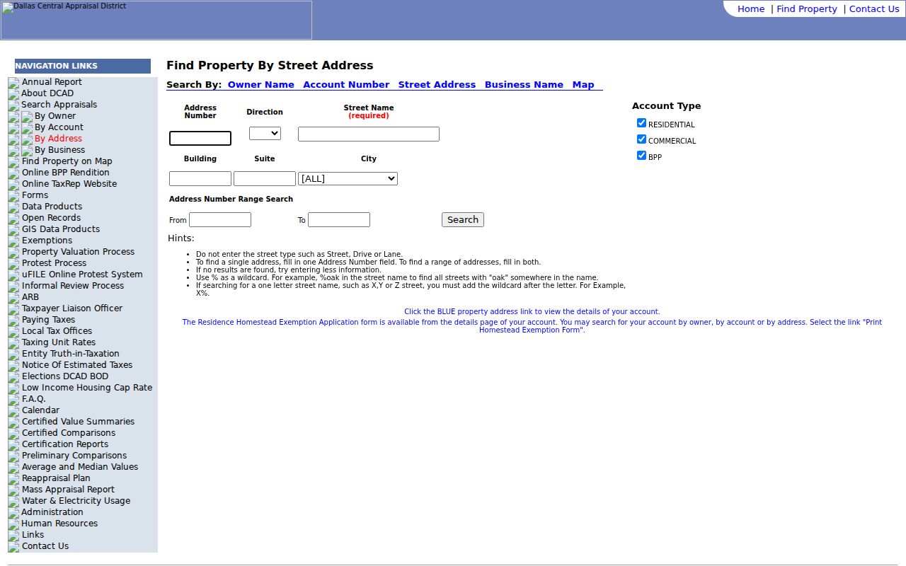
The captured screen is useful for an exact street or range, but it confirms the absence of a verified ZIP search control on that page.
| DCAD control | What the inspection established |
|---|---|
| By Owner, Account, Address, Business, Map | Separate search modes, with account preferred when already known. |
| Street name | Text field; two or more characters; omit street type; percent wildcard accepted. |
| City and building or suite | Separate fields available for address refinement. |
| From and To | Paired range inputs for an address segment. |
| Account-type filters | Residential, commercial, and BPP checkboxes were observed. |
A parcel card can show appraisal owner, situs, mailing address, subdivision, value, exemptions, sketch, and legal-description references. The mailing address may differ from the situs. Neither a DCAD card nor a ZIP result establishes who occupies every part of a parcel.
Mesquite ZIP Geography on Parcel Maps
The DCAD Property Map adds parcel geography after an address is confirmed. Its inspected controls include Search Parcel, Locate, Legend, measurement tools, basemap switching, and property report or map output. Search Parcel supports account, address, and owner formats. It is a way to connect a verified delivery point to a parcel and nearby subdivision, not a ZIP-wide people list or a certified survey.
The DCAD parcel map is shown here as the parcel step after a Mesquite postal verification.
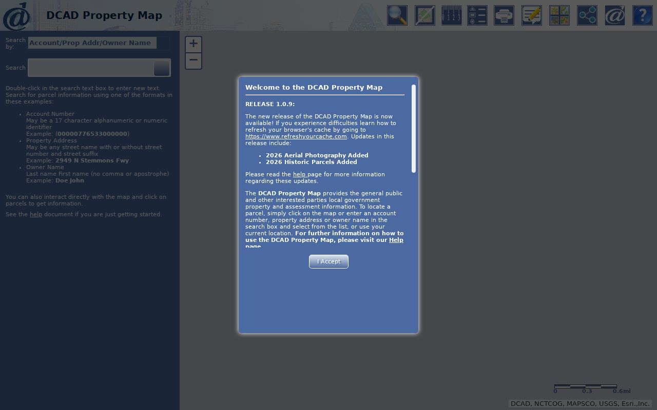
Its parcel, Locate, measurement, and report tools give local geography context while the appraisal record remains the source for appraisal details.
City layers add the jurisdiction test. The Mesquite parcel ArcGIS service lists Mesquite City Limit, Mesquite ETJ, floodplain, DCAD parcels, and subdivisions. It also distinguishes Dallas County and Kaufman County floodplain source years. The observed parcel service did not list a ZIP layer, so do not turn its polygons into a ZIP boundary.
The Mesquite GIS layer list shows the city-limit, ETJ, parcel, subdivision, and floodplain context.
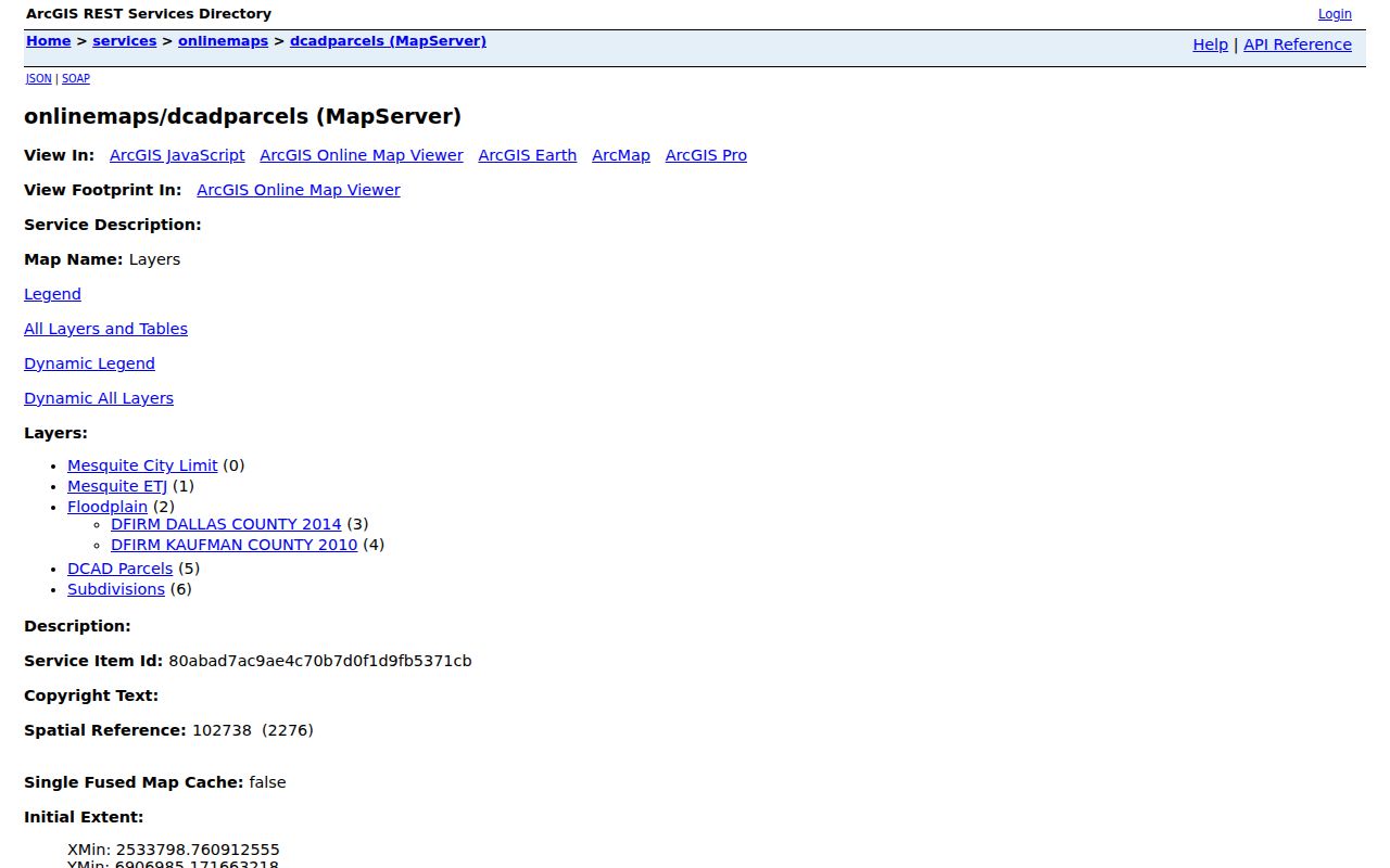
Those layers help select the correct jurisdiction for a record request, but they do not certify postal delivery or create a ZIP roster.
Mesquite Postal Areas and City Lines
The Census ZCTA guidance explains why city and ZIP answers can disagree. ZCTAs are generalized statistical approximations built from Census blocks. They are not USPS delivery routes and can include noncontiguous areas, enclaves, and PO-box or corporate-only patterns. Mesquite’s Dallas and Kaufman County context, surrounding municipalities, and historical destination-label changes make the difference practical rather than academic.
- ZIP Code and ZIP+4
- A ZIP Code identifies a postal delivery area. ZIP+4 adds a more specific delivery segment; neither is a city boundary.
- PO-box ZIP
- A postal ZIP used for box service. The research did not verify current PO-box status for 75187.
- Unique ZIP
- A ZIP assigned to one organization or delivery use. Do not assume one exists here without current USPS confirmation.
- Carrier route
- A postal delivery grouping used to move mail. It is not a public roll of residents.
Store the DCAD situs, tax mailing address, legal description, postal city, ZIP, county, and city-limit status as separate fields. That practice avoids the common error of treating a postal label as proof of municipal jurisdiction or property ownership.
Mesquite Voter Data by Geography
The Texas voter master-file layout includes permanent ZIP and mailing ZIP fields, but the public individual lookup is for a named voter, not ZIP-wide browsing. The City of Mesquite voting map maps a given address to a polling place, precinct, and districts. It does not provide names. The Secretary of State request form instead allows geography by statewide, district, county, or partial-county precinct selections, with possible data manipulation charges for a custom reduction.
The documented master-file route has a notarized affidavit, $75 deposit, full-payment requirement, and a statement that the information may not be used to advertise or promote commercial products or services. Sensitive identifiers and protected addresses are withheld, and Address Confidentiality Program participants do not receive normal public address display. For a ZIP question, USPS and parcel verification should come first; voter data is not a substitute for either.
Historical Mesquite ZIP Labels
Archived USPS material places 75180, 75185, and 75187 in a Mesquite and Balch Springs destination-label history. That is a useful records clue when an older document uses a postal city that differs from a current address result. It is not evidence that the archived label still applies. The reliable comparison is the date of the historic source, a current USPS result for the exact address, and the parcel’s city-limit and county layers.
This postal-history quirk is especially important when the city name, ZIP, and deed jurisdiction point in different directions. Use the legal description or account number to bridge the records. A ZIP field may help organize notes, but it cannot replace a parcel key when streets, subdivisions, and jurisdiction labels change over time.