
Walk a Mesquite Street by Address
A sound Mesquite street directory search begins with the full situs address, the physical location of the parcel. Keep the unit, postal city, ZIP, and search date with it. Mesquite is primarily a Dallas County city, yet its ETJ reaches into western Kaufman County. A Mesquite mailing address alone does not choose the right custodian. Check the city-limit and county context before taking the next step.
- Search the address in DCAD. Save the account or parcel identifier, the appraisal owner, situs address, mailing address, subdivision, and legal-description reference shown in the detail record.
- Open the DCAD or Mesquite map. Locate the target parcel, check the surrounding parcels, and note its subdivision plus city-limit or ETJ layer.
- Use the owner name and legal description in the Dallas County official-records index. Search the acquisition by grantee, then use the prior grantor as a grantee for the earlier conveyance.
- Use Texas voter information only to confirm a named person’s registration and polling information. The city voting map supplies precinct geography, not a street list of names.
- For a past household, consult a dated directory or library source and record its year. The historical shelf is discussed in more detail with the Mesquite city directory collections.
Each source answers a narrower question. An appraisal card identifies an appraisal relationship, a deed records a conveyance, a map places a parcel, and a directory prints a historical listing. None automatically proves that every person at the address lives there now.
Mesquite Street Directory at DCAD
DCAD’s By Address search is the quickest official starting point for a Mesquite street search. Its address page has separate owner, account, address, business, and map modes. An account number is the best key when known. For an address search, DCAD instructs users to omit the street type, use at least two street-name characters, and use a percent sign wildcard when a broader name search is needed.
| DCAD address control | Input | Mesquite street-use detail |
|---|---|---|
| Address Number | Number only | Use one number, or pair From and To for a segment. |
| Street Name | Required text | Two or more characters, no spaces, omit the type; % is allowed as a wildcard. |
| Direction | Optional dropdown | The control was visible, but its exact option text was not captured. |
| Building and Suite | Separate fields | Keep unit information separate from the street number. |
| City and account type | Filters | Account types shown include residential, commercial, and BPP. |
The blue property-address link opens the detail record. DCAD may display an owner, situs and mailing address, value, exemptions, and property characteristics, although the field set varies by account. A mailing address is where tax mail goes. It may differ from the parcel location and is not evidence of who occupies the site.
This DCAD address-search view shows the separate street, city, account-type, and range controls used for a Mesquite street directory query.
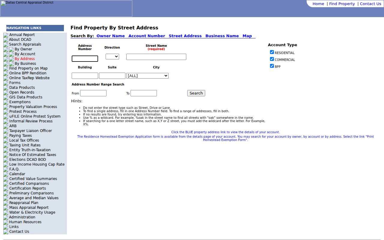
Use the range fields to identify parcels on a short segment, then capture each account separately instead of assuming one result represents the entire street.
Note: DCAD appraisal information is useful for parcel research, but DCAD says title documents belong with the county clerk.
Mesquite Street Parcels on the Map
The DCAD Property Map makes a street search spatial. Search Parcel accepts account, address, or owner formats. After selecting a parcel, the viewer provides Clear Selection, Locate, measurement, Legend, Create Map, and Create Property Report tools. A map boundary is approximate, so use it to organize parcel research, not to replace a survey or recorded description.
This DCAD parcel-map view shows the search, locate, measure, report, and basemap tools available while following a Mesquite street.
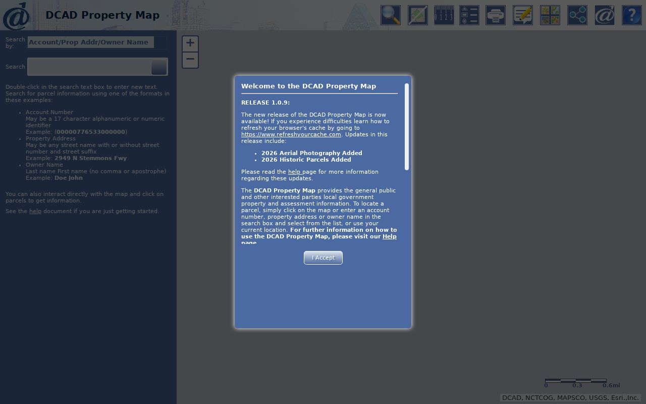
Once one parcel is selected, clear it before opening the next record so account numbers and notes stay tied to the correct lot.
The Mesquite parcel ArcGIS service adds local geography. Its listed layers include Mesquite City Limit, Mesquite ETJ, Floodplain, DCAD Parcels, and Subdivisions. The service can return query data in JSON, GeoJSON, or PBF and has a maximum record count of 1,000. That cap and the city’s mapping disclaimer are reasons to review a block carefully rather than treating an export as a final resident count.
The city parcel-service layer list identifies the location layers that help separate a Mesquite street inside the city from an ETJ address.
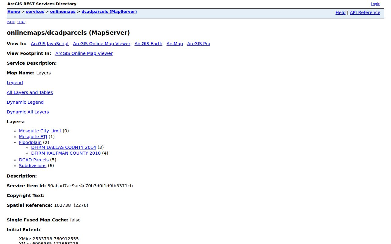
The flood layers identify Dallas County 2014 and Kaufman County 2010 DFIRM sources, a useful jurisdiction clue but not a resident record.
Mesquite Street Directory Record Coverage
Address-keyed records do not carry the same weight. Use this Mesquite street directory inventory to choose the next office and to state the result precisely. It also preserves the documented fallbacks when a public screen is incomplete or unavailable.
| Address record | Custodian | What it can show | Access route |
|---|---|---|---|
| Appraisal parcel | DCAD | Appraisal owner, situs, tax mailing address, values, exemptions, and characteristics | Address, account, owner, or map search |
| Parcel and subdivision map | Mesquite and DCAD | Parcel geometry, subdivision, city/ETJ, flood, zoning, and district context | Find Address, map selection, or public layer query |
| Deed, plat, lien | Dallas County Clerk | Parties, legal description, recorded date, and document trail | Public index, clerk counter, request forms, or certified-copy path |
| Voter information | Texas SOS and Dallas Elections | Individual registration or precinct geography, subject to confidentiality law | Individual lookup, city voting map, or formal file request |
| Permit or code material | Mesquite Building or City records | Project, inspection, or case information only if releasable | CSS workflow or narrow Public Information Act request |
| Historical directory | Library, UNT, or TSLAC | Dated address, telephone, business, or household listing | Volume-specific online, microfilm, library, or archive access |
For an older or inaccessible clerk record, the documented alternatives are the clerk’s public terminals and counter, mail or document-request forms, certified electronic documents where available, library microfilm, and Texas State Library reels. A Texas Public Information Act request seeks existing records. It does not require an agency to create a new street list.
Mesquite’s permit process runs through CSS Citizen Self Service. The city describes project information as the who, what, where, and how of a proposed project, with plans and inspections, but no verified public historical address-search screen was found. The GIS material lists code-enforcement data as a dataset category without showing that every case file is publicly releasable. For a permit or code question, name the address, record type, and date range in a narrow city request instead of guessing from a map layer.
Mesquite Street Permit Files by Address
Permit and code material can help date construction or explain a property change, but neither is a public household list. Mesquite routes current permit work through CSS Citizen Self Service. Its permit process describes project information, plans, inspections, and project-specific nonrefundable fees. The research did not locate a verified historical public permit-result screen that can be searched by a Mesquite street address.
When a project, inspection, or code case is not available online, use the city’s Texas Public Information Act route. Identify the street address, record type, date range, and preferred format. A city GIS layer may show that a dataset exists, but it does not establish that a person-level record or every underlying case file is releasable. The request asks for existing material; it does not require city staff to compile a street directory.
Preserve the requested address exactly, including unit and directional details. A narrow request is easier for the City of Mesquite to route and assess for redaction than an open-ended demand for all activity on a street.
Mesquite Street Deeds Without Numbers
A street number often disappears from an older instrument. The Dallas County official-records portal fills that gap with a Property Records quick search for grantor or grantee, subdivision, document type, or document number. It also offers Index Only and Index & Full Text OCR modes, recorded-date fields, and preset date ranges. The inspected portal showed certification through August 25, 2026, but it did not display an oldest online index year.
The Dallas County deed-index search is the official screen for moving from a Mesquite parcel’s owner and legal description into recorded documents.
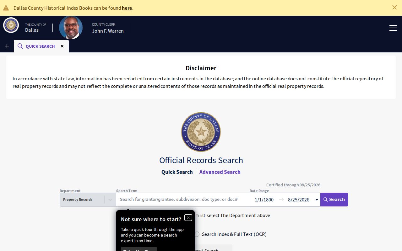
Start with the current owner as grantee. Read the seller, document number, date, subdivision, lot or block, and legal description. Search that seller as a grantee to step back another conveyance. If a parcel was split or combined, follow the plat and legal description, not the present street number. Deeds establish ownership history, not a current household roster.
- Parcel
- A mapped unit of property associated with an account or parcel identifier.
- Situs address
- The physical parcel location, distinct from the place where tax mail is sent.
- Plat
- A recorded subdivision map that can connect a lot and block to an address.
- Criss-cross directory
- A reverse-style directory organized by address when the volume actually includes that index.
Dallas County’s custodian says its records reach back to 1846. That is not an online cutoff. Older documents, unclear portal years, and temporarily unavailable bands require the clerk, microfilm, or an archive route.
Mesquite Street Names Need a Stable Key
Historic address research can fail when a document uses a subdivision, lot and block, abbreviated street, or former county description rather than a present street number. No official source in the research verified a citywide Mesquite renumbering or readdressing year. Do not fill that gap with a date taken from an unrelated address history.
Use the legal description from a deed or DCAD record as the stable bridge. Then compare the parcel’s subdivision with the city’s planning maps, including the documented 2006 annexation, 2008 subdivision, and 2011 zoning maps. A plat can show a changed or replatted lot when the street number no longer matches. This method preserves the record’s own language while still letting a reader place it on a present map.
Note: A matching postal street name is useful, but a legal description and parcel account carry more weight when historical address formats disagree.
Mesquite Street Voter Boundaries
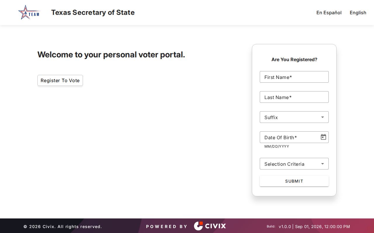
The Texas voter information lookup is for individual confirmation, not browsing a street. VoteTexas says matching may use a VUID, a Texas driver’s-license number if supplied, or first and last name. It can confirm registration and polling information. The live form did not render during source inspection, so its exact field order, required marks, button labels, and result layout remain a research gap.
This Texas voter-information screen is the official individual-confirmation route referenced for a Mesquite street record.
Texas Election Code sections 13.004 and 18.005 limit the handling of voter data. Sensitive identifiers and protected-address information are withheld. The City of Mesquite voting map can connect an address to a precinct, district, and polling place, but it does not return names.
A state voter-file request is a separate process. The inspected form calls for a notarized affidavit and a $75 deposit, states a delivery deadline no later than the fifteenth day after receipt, and bars use of the file to advertise or promote commercial products or services. Do not describe that request as a public block roster.
Note: A voter result can support registration context for one named person, not a claim that all people at a Mesquite address are known.
Mesquite Street Records Across Boundaries
Mesquite’s incorporated area sits in east-central Dallas County, while the city’s ETJ reaches about five miles into western Kaufman County. The ETJ covers roughly 19 square miles, primarily south of Forney and west of Crandall, and is bisected by I-20. A postal city name can therefore point to a different county or city status than the parcel itself.
Save four labels together when working a Mesquite street: postal city, county, city-limit or ETJ status, and legal parcel description. City planning material also provides 2006 annexation, 2008 subdivision, and 2011 zoning maps. These can explain why a historic reference and a modern map use different geography, without inventing an address-renumbering story. No official source reviewed verified a Mesquite citywide street-renumbering year.
The city map is therefore a jurisdiction detector as well as a street tool. Select the parcel first, then confirm whether the record belongs with Dallas County, Kaufman County, the City of Mesquite, or more than one custodian for different record types. That careful split prevents a correct address from being sent to the wrong records office.
Mesquite Street Directory Privacy Limits
The Mesquite street directory cannot reveal a complete household. Public sources may omit non-owner household members, guests, utility customers, and motor-vehicle addresses. The Driver’s Privacy Protection Act restricts motor-vehicle personal information. Texas Address Confidentiality Program participants, protected voters, sealed proceedings, and juvenile details also have safeguards. A missing row is not proof that someone was absent.
Texas’s Data Privacy and Security Act gives rights against covered private controllers, but it does not erase Dallas County deeds or require a public custodian to delete an existing record. Ask DCAD about an appraisal correction, the clerk about an index or recording correction path, and elections about a voter-record correction. Keep the record identifier and request a written explanation of any denial or exception.
Lawful use. Use Mesquite address records for personal, lawful research such as family history, property questions, civic transparency, or confirming a record with its custodian. Texas Penal Code sections 42.07 and 42.072 address harassment and stalking; do not use records to monitor, threaten, or repeatedly contact anyone.